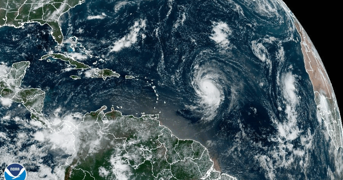
Hurricane Lee, now a powerfulCategory 5 stormchurning in the Atlantic, is expected to continue strengthening Friday as it makes its way west, the National Hurricane Center says.
While the storm’s intensity could fluctuate in the coming days, “Lee is expected to remain a major hurricane through early next week,” the center said late Thursday night.
Large ocean swells generated by Lee are expected to reach the Lesser Antilles by Friday, and the U.S. and British Virgin Islands, Puerto Rico, the Bahamas, Bermuda, the Turks and Caicos Islands and Hispaniola by the weekend, the hurricane center said.
“These swells are likely to cause life-threatening surf and rip current conditions,” the agency reported.
However, Lee’s center is forecast to pass “well to the north” of those islands, the agency added.
As of 11 p.m. ET on Thursday, Lee had maximum sustained winds of 160 mph. Its center was about 705 miles east of the northern Leeward Islands, and it was traveling west-northwest at 14 mph over the Atlantic Ocean.
Thelong-term track for Lee remains unclearas meteorologists continue monitoring the storm for signs it could shift over the open ocean and turn more toward the mainland U.S. coast, with questions circulating about the potential path it could take.
“Even as we head into Saturday, Sunday, Monday and Tuesday it does weaken, that’s good news as it heads towards the U.S.,” CBS News senior weather and climate producer David Parkinson said Friday night.
Parkinson laid out a few possible scenarios for Lee. One would involve a cold front coming off the East Coast that could trap Lee and push it north against the coastline, bringing potentially stormy weather to areas along the coast.
However, if no cold front were to form, Parkinson explained that Lee would then potentially stay out at sea for a longer period until it were to reach Newfoundland and Labrador in Canada. By that point, it may be significantly weakened.
As meteorologists predicted, Lee has gained strength quickly. Early Wednesday, Lee’s center was packing maximum sustained winds of 65 mph — a pickup of 15 mph in mere hours. It then grew into a hurricane, which happens when a storm’s maximum sustained wind speeds reach 74 mph, according to theSaffir-Simpson scale.
Once wind speeds exceed 95 mph, it was upgraded to Category 2, and when maximum sustained winds reached 111 mph, it became a major Category 3 storm. A Category 4 has winds of 130 to 156 mph, and Category 5 hits 157 mph or higher.
Meteorologists consider storms that fall within Category 3, 4, or 5 on the ranking scale to be “major” hurricanes, due to their potential to cause “significant loss of life and damage,” the National Hurricane Center says.
Officials have not yet issued any storm or hurricane watches or warnings for places that could potentially be in Lee’s path.
This comes just days afterHurricane Idalialeft a path of destruction across the Southeast.
How do hurricanes get their names? A look at the naming process and 2023’s full list
That storm made landfall Wednesday in Florida, where it razed homes and downed power poles. It then headed northeast,slamming Georgia, flooding many of South Carolina’s beachfrontsand sending seawater into the streets of downtown Charleston. In North Carolina, it poured more than 9 inches of rain on Whiteville, flooding downtown buildings.
Idalia claimed at least two lives, one in Florida and the other in Georgia.
Idalia’s impact from damage and lost economic activity isexpected to be in the $12 to $20 billion range, according to Moody’s Analytics.


